Survey-grade geotags in every shot — written automatically.
TAG-E is a purpose-built controller and EXIF geotagger for the Sony ILX-LR1. One USB-C cable. No WiFi, no extra modules. Full MAVLink camera control, with precise position & attitude written into every photo — no initiation, no manual log-matching.
Purpose-built for the ILX-LR1. Full access. No compromises.
Designed from scratch for the ILX-LR1. The firmware inside TAG-E is written specifically for this camera, which is what lets it reach the full spectrum of what the ILX-LR1 can do — the complete set of exposure and focus controls, every menu and button, and the richest geotagging the camera will accept. Nothing is generalised away, so nothing is left on the table.
Automatic EXIF geotagging
Latitude, longitude, altitude and camera angles are written into the files on the camera's SD card — JPG, ARW raw, or both, whichever way you shoot. No initiation, no manual log-matching.
No capture slowdown
Trigger at the camera's maximum rate — geotagging never throttles your shot interval, so overlap stays tight on long mapping missions.
One USB-C cable
A single USB-C link handles control and geotagging (plus an optional trigger-detect wire). No WiFi, no expander boxes — less weight, fewer failure points.
Full camera control
Trigger, exposure and every camera button over USB — ISO, iris, shutter, exp. comp, exposure mode, AF, even MENU navigation and image playback, all from QGC or the Mission Planner plugin.
RTK positioning & precise timestamps
Geotag precise GPS/RTK position taken from MAVLink, EMLID ERB or NMEA input. A separate PPS input tightens time synchronisation, so each capture carries a highly precise timestamp.
Auto clock sync
TAG-E automatically sets the camera's internal clock and time zone from the GPS time received from the drone, so every photo the camera writes carries the correct date and time — no manual clock setting, even after long storage.
Automatic GPS delay jitter correction, backed by Timesync protocol v2.
Call it timing magic: TAG-E and the flight controller share one perfectly synchronized clock. So even with a gimbal or MavPorter in the mix, every photo gets tagged with the drone’s true position at the exact moment it was captured — never a stale guess.
Direct georeferencing, straight out of the camera.
TAG-E pulls the full drone-ecosystem context from the flight controller and embeds it into every image automatically — so images arrive photogrammetry-ready, straight off the card.
- ✓Standard: GPS/RTK position, altitude and camera attitude (Roll/Pitch/Yaw from frame + gimbal), written to EXIF & XMP of every photo.
- ✓Optional: GPS date & time, relative altitude, laser rangefinder distance, GPS & IMU accuracy (fix type, XY / Z accuracy), focal length & focal-plane resolution, separate frame & gimbal angle tags, and a custom flight label.
- ✓Precision workflows: lever-arm offset correction and PPK TXT output for the highest-accuracy stitching results.
- ✓Video too: position, attitude and rangefinder data embedded as SRT subtitles alongside the recording.
EXIF written to every image
GPSLongitude : 14.428611 E
GPSAltitude : 118.4 m
CameraYaw : 271.6°
CameraPitch : -89.4° (nadir)
CameraRoll : 0.3°
SubjectDistance : 42.7 m (laser)
GPSDateStamp : 2026:07:21
GPSTimeStamp : 09:14:02 UTC
XMP:Label : Site-A / Line-3
Standard tags are written to every photo. Optional tags can be switched on per project or workflow. Attitude includes gimbal orientation when a gimbal is used.
Label every flight, right from your controller
Before you take off, type a name for the job — site, line, tower, whatever suits — straight into the control interface TAG-E generates in QGroundControl. No config files, no SD card, no laptop. That label is written into every image from the flight, so your photos come back already sorted by mission.

Made to fit your whole setup.
TAG-E fits easily into your current setup. Add it alongside the flight controller and camera you already fly, and you’re ready to go.

Your angle. Your position. Always right.
However you fly the ILX-LR1 — bolted to the frame or riding a gimbal — every photo knows exactly where it was taken and which way it was looking. Saved in EXIF of each photo in the camera.
Bolted to the frame
Point the camera straight down for mapping, or tilt it for oblique capture. Tell TAG-E the angle once and it stamps the right direction onto every shot. Set it and forget it.
Riding a gimbal
Let the gimbal do its thing. TAG-E follows its every move — Gremsy, BaseCam or any MAVLink gimbal — so your shots always report the real camera angle, however the drone dances around it.
Coordinates that point at the camera, not the antenna
Your GPS sits in one place and your camera in another. Behind the scenes it’s proper 3D geometry — TAG-E fuses the flight controller’s IMU attitude (roll, pitch and yaw of the airframe) with the live gimbal angles to work out the camera’s true offset, and recalculates its exact point in space for every single frame — so your map pins land precisely where the camera really was, down to the millimeter, even mid-banked-turn. All that number-crunching, and you set it up just once.
This animation is a simplified demonstration. It shows the antenna-to-camera lever arm calculation only. In reality, when the camera rides a gimbal, TAG-E also factors in the gimbal’s own rotation — a second lever-arm calculation stacked on top of the one shown here — to resolve the camera’s true position and pointing angle.
The whole camera, from the ground.
TAG-E doesn’t just tag your shots — it drives the ILX-LR1 over that same single USB-C link. Exposure, focus, triggering, even the menu: all of it, from your ground station.
Exposure, your way
Switch from fully automatic to fully manual in a tap — or anywhere in between. Set ISO, aperture and shutter individually, or let the camera decide.
Where it helps: lock manual exposure so every frame across a survey block matches for seamless, even orthomosaics — then flip to auto for run-and-gun inspection in changing light.
Trigger it from your mission
Fire stills or video straight from your flight plan or GCS. TAG-E accepts the standard MAVLink camera commands and executes them on the camera over USB-C — distance and interval triggers, plus photo and video start/stop.
DO_SET_CAM_TRIGG_DIST
DO_SET_CAM_TRIGG_INTERVAL
IMAGE_START_CAPTURE
IMAGE_STOP_CAPTURE
VIDEO_START_CAPTURE
VIDEO_STOP_CAPTURE
Every button, remotely
Reach the whole camera without touching it: open the MENU, navigate with the arrows, hit Fn, and play back captured images and clips — all from the ground. Change a buried setting mid-flight, no landing required.
And more
Format the SD card remotely, keep each flight in its own folder automatically, and fix HDMI output resolution — the housekeeping handled, so your operators don’t have to.
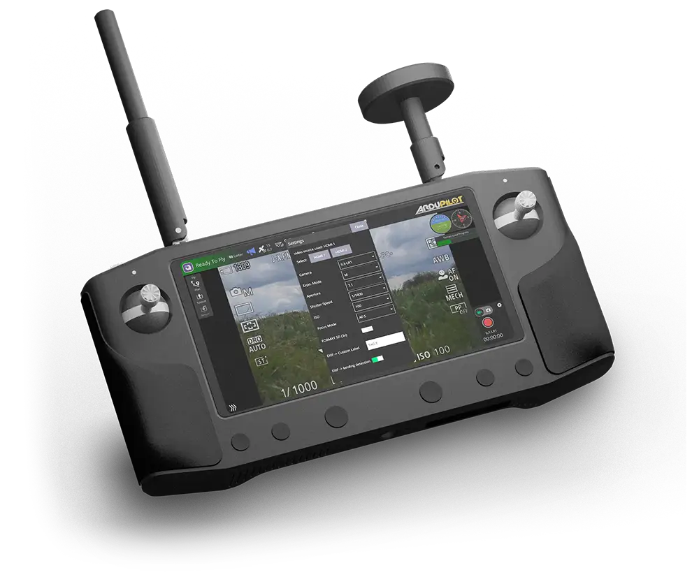
Control for every new Sony camera.
TAG-E’s camera control isn’t tied to a single body. Triggering and full exposure control work across the latest Sony cameras, over the same USB link and the same MAVLink workflow. Drive more of your fleet with one familiar tool.
Full EXIF & XMP geotagging stays exclusive to the Sony ILX-LR1 — the camera TAG-E was purpose-built around.
Sharp where it counts.
Choose the autofocus behaviour that suits the job — continuous AF-C, single AF-S, or full manual focus — and put the focus exactly where you want it.
- ✓Mapping: lock focus with AF-S or MF at infinity so it never hunts between frames — consistently crisp imagery across the whole block.
- ✓Inspection: let AF-C ride along and keep a moving subject tack-sharp.
- ✓Point & area control: move the focus point anywhere across the frame — left/right or a precise 0–100% position in width and height.
- ✓Tap to focus: wire it straight into your own app — tap the live view, TAG-E focuses there.
Tap-to-focus isn’t part of QGroundControl, Mission Planner or MavCam today — TAG-E exposes it as a capability for the integrator to build into their own application.
Video that knows where it’s looking.
Record with the ILX-LR1 and TAG-E writes a matching subtitle track — position, altitude, camera attitude and laser distance, frame by frame. Scrub to any moment and you know exactly where the camera was and what it was pointing at. A walkthrough clip becomes a located, reportable record.
Correct date & time, automatically.
TAG-E reads GPS time from the drone and sets the camera’s internal clock and time zone for you. Every photo the camera writes carries the right date and time — no more fixing timestamps after the battery’s been out, no drift between flights.

Most interesting use cases
Each one below is unlocked by a specific TAG-E capability — from rangefinder defect-sizing to sub-cm RTK survey and geotagged video. The same coin-sized module covers them all.
Crack & defect sizing on turbines & concrete
TAG-E writes the laser rangefinder distance into every shot, so software can turn pixels into millimetres. Measure crack widths, spalling and corrosion on wind-turbine blades, bridges, dams, chimneys and cooling towers — no physical scale bar in frame.
Vertical & facade structure inspection
Fly oblique against buildings, towers and cell masts. Gimbal-derived Roll/Pitch/Yaw plus rangefinder distance mean every frame carries its true viewing angle and range — so findings map back to an exact spot on the structure.
Per-asset tagging for inspection databases
Stamp a custom label — tower ID, line, span, pole number — into the metadata of every image as you fly. Photos arrive pre-sorted and traceable, ready to ingest into an asset-management system without manual renaming.
Precision survey & stockpile volumetrics
With RTK/PPK positioning and lever-arm correction, TAG-E embeds centimetre-accurate position and PPK TXT output, giving your processing software a precise starting point alongside your ground control. Ideal for cadastral survey, mining and aggregate stockpile volumes, and earthworks.
Emergency mapping with zero post-processing
Geotagging needs no initiation and no manual log-matching. A single operator lands and hands over survey-ready imagery — perfect for search & rescue, disaster assessment and time-critical BVLOS missions.
Geotagged video inspection & reporting
TAG-E generates SRT subtitles carrying position, attitude and laser distance alongside recorded video. Reviewers can pinpoint exactly where a defect appears in the footage — turning a walkthrough clip into a located, reportable record.
Repeat & time-series monitoring
Tag each campaign with a custom label and rely on consistent, automatic metadata to compare flights over time — construction progress, coastal erosion, subsidence, tailings dams, crop cycles — with every image already positioned and dated from GPS.
Survey-grade photogrammetry payload
Fly large corridors and blocks with the 61 MP ILX-LR1 and land with images already carrying position and attitude in EXIF & XMP. Feed straight into Pix4D / Metashape and lean on direct georeferencing to speed up stitching.
Drop-in module & easy ENTIRE upgrade
At 27×46×9 mm with a single USB-C link and no WiFi to certify, TAG-E designs cleanly into a production airframe. MavCam backward compatibility and full ENTIRE R3 command support make upgrading an existing fleet painless for you and your customers.
Add the ILX-LR1 to your own ArduPilot / PX4 rig
Building or upgrading your own drone? Wire one cable, load the plugin, and get professional geotagging and full camera control — including remote MENU navigation, so you never land just to change a setting — without a companion computer or scripting.
Whether you ship hundreds or build one.
Drone manufacturers
A predictable, small-footprint module you can design into a production payload. Standard MAVLink integration means your customers control the camera from tools they already use — and your support team fields fewer questions. Simple wiring, no WiFi to certify, consistent EXIF output across every unit you ship.
Custom & DIY builders
Get OEM-grade geotagging on a self-built ArduPilot or PX4 drone without a companion computer or custom code. One cable, a plugin, and you're capturing survey-ready imagery. The same device the professionals use — approachable enough for a one-off build.
Which AirPixel geotagger is right for you?
TAG-E is the focused, simplest path for the ILX-LR1. ENTIRE is the universal workhorse that drives many camera brands — but that flexibility comes at a price: paired with the ILX-LR1 it can’t reach everything the camera offers. TAG-E, built for this one camera, has none of those limits.

| Feature | TAG-E | ENTIRE R3 |
|---|---|---|
| Camera support | Purpose-built for Sony ILX-LR1 | Universal — Sony, PhaseOne Industrial, Workswell Wiris & more |
| Connection | Single USB-C, no WiFi | USB for geotagging + WiFi (or wired expander) |
| Setup complexity | Minimal — a few options | More configuration (universal by design) |
| Geotagging accuracy | Same high accuracy | Same high accuracy |
| EXIF & XMP geotagging | ✓ | ✓ |
| Lever-arm offset calculation | ✓ | ✓ |
| Rangefinder geotagging | ✓ | ✓ |
| Custom flight label | ✓ | ✗ |
| Movie SRT video geotagging | ✓ | ✗ |
| PPS GPS time synchronisation | ✓ | ✗ |
| PPK TXT output | ✓ | ✗ |
| Automatic camera clock from GPS | ✓ | ✗ |
| Camera control protocol v2 | ✓ | ✗ |
| Full MAVLink parameter config | ✓ | ✗ |
| Remote SD-card format | ✓ | ✗ |
| SBUS / Jeti / PWM / Link control input | ✗ | ✓ |
| Best fit | Standardising on the ILX-LR1 | Mixed fleets & other camera brands |
Not sure which fits your airframe? The AirPixel team can advise based on your camera and flight controller.
Specifications & compatibility
Control & integration
- ✓QGroundControl auto-detected exposure, trigger & timelapse controls (Android / PC / Mac)
- ✓Mission Planner camera & geotagging plugin
- ✓MAVLink Camera Protocol v2 · MavCam & ENTIRE R3 command compatible
- ✓ArduPilot & PX4 flight stacks
Geotagging & data
- ✓Automatic EXIF & XMP: position, altitude, camera Roll/Pitch/Yaw
- ✓GPS/RTK input via MAVLink, EMLID ERB or NMEA · PPS timestamp precision
- ✓Optional: GPS time, rangefinder, GPS/IMU accuracy, custom label · lever-arm correction · PPK TXT output
- ✓Video geotagging via SRT subtitles
Put professional geotagging on your ILX-LR1.
Order TAG-E for €299, or talk to us about integrating it into your drone platform. MavCam backward compatible — an easy upgrade from the ENTIRE R3.